25 Best 「map」 Books of 2025| Books Explorer
- Strange Maps: An Atlas of Cartographic Curiosities
- Map As Art, The: Contemporary Artists Explore Cartography
- From Here to There: A Curious Collection from the Hand Drawn Map Association
- You Are Here: Personal Geographies and Other Maps of the Imagination (Imagined Maps Around the World, Collection of Artists Maps)
- An Atlas of Radical Cartography
- Cartographies of Time
- Maps of the Imagination: The Writer as Cartographer
- Transit Maps of the World: The World's First Collection of Every Urban Train Map on Earth
- Where the Animals Go: Tracking Wildlife With Technology in 50 Maps and Graphics
- Die Wege der Tiere: Ihre Wanderungen an Land, zu Wasser und in der Luft - in 50 Karten

An intriguing collection of more than one hundred out-of-the-ordinary maps, blending art, history, and pop culture for a unique atlas of humanity Spanning many centuries, all continents, and the realms of outer space and the imagination, this collection of 138 unique graphics combines beautiful full-color illustrations with quirky statistics and smart social commentary. The result is a distinctive illustrated guide to the world. Categories of cartographic curiosities include: ? Literary Creations, featuring a map of Thomas More?s Utopia and the world of George Orwell?s 1984 ? Cartographic Misconceptions, such as a lavish seventeenthcentury map depicting California as an island ? Political Parody, containing the ?Jesusland map? and other humorous takes on voter profiles ? Whatchamacallit, including a map of the area codes for regions where the rapper Ludacris sings about having ?hoes? ? Obscure Proposals, capturing Thomas Jefferson?s vision for dividing the Northwest Territory into ten states with names such as Polypotamia and Assenisipia ? Fantastic Maps, with a depiction of what the globe might look like if the sea and land were inverted The Strange Maps blog has been named by GeekDad Blog on Wired.com ?one of the more unusual and unique sites seen on the Web that doesn?t sell anything or promote an agenda? and it?s currently ranked #423 on Technorati?s Top 500 Blogs. Brimming with trivia, deadpan humor, and idiosyncratic lore, Strange Maps is a fascinating tour of all things weird and wonderful in the world of cartography.

Maps can be simple tools, comfortable in their familiar form. Or they can lead to different destinations: places turned upside down or inside out, territories riddled with marks understood only by their maker, realms connected more to the interior mind than to the exterior world. These are the places of artists' maps, that happy combination of information and illusion that flourishes in basement studios and downtown galleries alike. It is little surprise that, in an era of globalized politics, culture, and ecology, contemporary artists are drawn to maps to express their visions. Using paint, salt, souvenir tea towels, or their own bodies, map artists explore a world free of geographical constraints. Katharine Harmon knows this territory. As the author of our best-selling book You Are Here, she has inspired legions of new devotees of imaginative maps. In The Map as Art, Harmon collects 360 colorful, map-related artistic visions by well-known artistssuch as Ed Ruscha, Julian Schnabel, Olafur Eliasson, Maira Kalman, William Kentridge, and Vik Munizand many more less-familiar artists for whom maps are the inspiration for creating art. Essays by Gayle Clemans bring an in-depth look into the artists' maps of Joyce Kozloff, Landon Mackenzie, Ingrid Calame, Guillermo Kuitca, and Maya Lin. Together, the beautiful reproductions and telling commentary make this an essential volume for anyone open to exploring new paths.
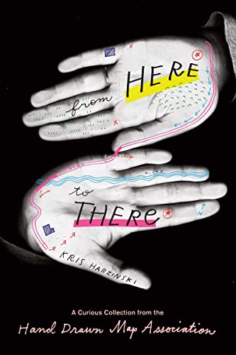
It's a situation we are all acquainted with: planning to visit friends in an unfamiliar part of the city, you draw yourself arudimentary map with detailed directions. In March 2008, graphic designer Kris Harzinski founded the Hand Drawn Map Association in order to collect just such drawings of the everyday. Fascinated by these accidental records of a moment in time, he soon amassed a wide variety of maps, ranging from simple directions to fictional maps, to maps of unusual places, including examples drawn by well-known historical figures such as Abraham Lincoln, Ernest Shackleton, and Alexander Calder. From Here to There celebrates these ephemeral documentsusually forgotten or tossed aside after having served their purposegiving them their due as artifacts representing stories from people's lives around the world. There is the young woman suffering from juvenile rheumatoid arthritis who created maps of the Humira injections on her stomach and thighs to help her remember the sites, and give them time to heal. Or the young boy who imagined a whole country for ants and put it to paper. Lucas from Australia drew an obsessively detailed map of his local traffic island, and a teenage girl contributed a map of her high school locker. Two American tourists got lost in the Bulgarian mountains following the hand drawn map of a local, and Britanny from Denmark drew directions to an animal rights protest in Copenhagen. The maps featured in From Here to There are as varied and touching as the stories they tell.

Mapmaking fulfills one of our most ancient and deepseated desires: understanding the world around us and our place in it. But maps need not just show continents and oceans: there are maps to heaven and hell; to happiness and despair; maps of moods, matrimony, and mythological places. There are maps to popular culture, from Gulliver's Island to Gilligan's Island. There are speculative maps of the world before it was known, and maps to secret places known only to the mapmaker. Artists' maps show another kind of uncharted realm: the imagination. What all these maps have in common is their creators' willingness to venture beyond the boundaries of geography or convention.You Are Here is a wide-ranging collection of such superbly inventive maps. These are charts of places you're not expected to find, but a voyage you take in your mind: an exploration of the ideal country estate from a dog's perspective; a guide to buried treasure on Skeleton Island; a trip down the road to success; or the world as imagined by an inmate of a mental institution. With over 100 maps from artists, cartographers, and explorers, You are Here gives the reader a breath-taking view of worlds, both real and imaginary.

An Atlas of Radical Cartography makes an important contribution to a growing cultural movement that traverses the boundaries between art, cartography, geography and activism. It pairs writers with artists, architects, designers and collectives to address the role of the map as political agent (rather than neutral document). Ten mapping projects dealing with social and political issues such as migration, incarceration, globalization, housing rights, garbage and energy issues are complemented by 10 critical essays and dialogues responding to each map. The maps themselves are printed as posters, unbound for leisurely perusal. Among the contributors are artists Trevor Paglen, John Emerson, Ashley Hunt and Pedro Lasch and essayists Avery Gordon, Heather Rogers, Alejandro De Acosta and Jenny Price. An Atlas of Radical Cartography also serves as a catalogue to the exhibition An Atlas, which has been touring the United States and internationally since July of 2007.

what Does History Look Like? How Do You Draw Time? from The Most Ancient Images To The Contemporary, The Line Has Served As The Central Figure In The Representation Of Time. The Linear Metaphor Is Ubiquitous In Everyday Visual Representations Of Time—in Almanacs, Calendars, Charts, And Graphs Of All Sorts. Even Our Everyday Speech Is Filled With Talk Of Time Having A Before And An After Or Being Long And Short. The Timeline Is Such A Familiar Part Of Our Mental Furniture That It Is Sometimes Hard To Remember That We Invented It In The First Place. And Yet, In Its Modern Form, The Timeline Is Not Even 250 Years Old. The Story Of What Came Before Has Never Been Fully Told, Until Now. cartographies Of Time Is The First Comprehensive History Of Graphic Representations Of Time In Europe And The United States From 1450 To The Present. Authors Daniel Rosenberg And Anthony Grafton Have Crafted A Lively History Featuring Fanciful Characters And Unexpected Twists And Turns. From Medieval Manuscripts To Websites, Cartographies Of Time Features A Wide Variety Of Timelines That In Their Own Unique Ways—curving, Crossing, Branching—defy Conventional Thinking About The Form. A Fifty-four-foot-long Timeline From 1753 Is Mounted On A Scroll And Encased In A Protective Box. Another Timeline Uses The Different Parts Of The Human Body To Show The Genealogies Of Jesus Christ And The Rulers Of Saxony. Ladders Created By Missionaries In Eighteenth-century Oregon Illustrate Bible Stories In A Vertical Format To Convert Native Americans. Also Included Is The April 1912 Marconi North Atlantic Communication Chart, Which Tracked Ships, Including The Titanic, At Points In Time Rather Than By Their Geographic Location, Alongside Little-known Works By Famous Figures, Including A Historical Chronology By The Mapmaker Gerardus Mercator And A Chronological Board Game Patented By Mark Twain. Presented In A Lavishly Illustrated Edition, cartographies Of Time Is A Revelation To Anyone Interested In The Role Visual Forms Have Played In Our Evolving Conception Of History. The Barnes & Noble Review rosenberg And Grafton's Generously Illustrated Book Investigates The Ways That Time Has Been Represented Graphically. They Begin In The Fourth Century With The Theologian Eusebius Of Caesarea's chronicle, A Lengthy Register Of Important Dates That Placed The Story Of Christianity -- And Rome's Domination -- In The Context Of The Histories Of Other Nations. Significant Advances In The Development Of The Timeline Are Carefully Explained, Including Gerardus Mercator's Incorporation Of Astronomical Data In The Fifteenth Century And The Eighteenth-century Scientist Joseph Priestley's Simple But Groundbreaking Charts Of History And Biography, Which Made The Grand Sweep Of Time Immediately Visible On A Single Page.

In Maps of the Imagination, Peter Turchi posits the idea that maps help people understand where they are in the world in the same way that literature, whether realistic or experimental, attempts to explain human realities. The author explores how writers and cartographers use many of the same devices for plotting and executing their work, making crucial decisions about what to include and what to leave out, in order to get from here to there, without excess baggage or a confusing surplus of information. Turchi traces the history of maps, from their initial decorative and religious purposes to their later instructional applications. He describes how maps rely on projections in order to portray a three-dimensional world on the two-dimensional flat surface of paper, which he then relates to what writers do in projecting a literary work from the imagination onto the page.

Transit Maps of the World is the first and only comprehensive collection of historic and current maps of every rapid-transit system on earth. Using glorious, colorful graphics, Mark Ovenden traces the history of mass transit-including rare and historic maps, diagrams, and photographs, some available for the first time since their original publication. Transit Maps is the graphic designer's new bible, the transport enthusiast's dream collection, and a coffee-table essential for everyone who's ever traveled in a city.

"Where the Animals Go is beautiful and thrilling, a combination of the best in science and exposition, and a joy to study cover to cover." ―Edward O. Wilson, University Research Professor Emeritus, Harvard University\nFor thousands of years, tracking animals meant following footprints. Now satellites, drones, camera traps, cellphone networks, and accelerometers reveal the natural world as never before. Where the Animals Go is the first book to offer a comprehensive, data-driven portrait of how creatures like ants, otters, owls, turtles, and sharks navigate the world. Based on pioneering research by scientists at the forefront of the animal-tracking revolution, James Cheshire and Oliver Uberti’s stunning, four-color charts and maps tell fascinating stories of animal behavior. These astonishing infographics explain how warblers detect incoming storms using sonic vibrations, how baboons make decisions, and why storks prefer garbage dumps to wild forage; they follow pythons racing through the Everglades, a lovelorn wolf traversing the Alps, and humpback whales visiting undersea mountains. Where the Animals Go is a triumph of technology, data science, and design, bringing broad perspective and intimate detail to our understanding of the animal kingdom. 100 color illustrations; 3 gatefolds


In his classic text, two-time Pulitzer Prize-winner John Noble Wilford recounts the history of cartography from antiquity to the space age. They are among the world's great pioneers and adventurers: the mapmakers who for centuries have been expanding our knowledge of who and where we are, and where we want to go. From the surprisingly accurate silk maps prepared by Chinese cartographers in the second century B.C., to medieval mapmakers who believed they had fixed the location of paradise, through to the expeditions of Columbus and Magellan, John Noble Wilford chronicles the exploits of the great pioneers of mapmaking. Wilford brings the story up to the present day as he shows the impact of new technologies that make it possible for cartographers to go where no one has been before, from the deepest reaches of the universe (where astronomers are mapping time as well as space) to the inside of the human brain. These modern-day mapmakers join the many earlier adventurers—including ancient Greek stargazers, Renaissance seafarers, and the explorers who mapped the American West—whose achievements shape this dramatic story of human inventiveness and limitless curiosity.

Cet Atlas Est Un Merveilleux Voyage Aux Quatre Coins Du Monde Sur Les Pas Des Animaux Sauvages. Grâce Aux Technologies Les Plus Avancées, Nous Suivons à La Trace Les Déplacements D'éléphants Traqués Par Les Braconniers, De Tortues Traversant L'atlantique à Contre-courant, D'un Loup Parcourant Plus De Mille Kilomètres à Travers Les Alpes En Plein Hiver Ou Encore De Fauvettes Esquivant Les Tornades. On Apprend également Comment Les Fourmis Ont Inspiré Des Entreprises De Livraison à Domicile, Comment Les Babouins Prennent Leurs Décisions De Groupe Ou Comment Les Mésanges Sélectionnent Leurs Voisins De Table... Ces Histoires étonnantes Et Fascinantes, Fruits Des études Les Plus Récentes, Nous Montrent Qu'il Est Encore Possible De Mieux Connaître La Vie Sauvage Et De Mieux La Protéger.

A National Bestseller, a New York Times Notable Book, and an Entertainment Weekly Best Book of the YearIt's the summer of 1854, and London is just emerging as one of the first modern cities in the world. But lacking the infrastructure-garbage removal, clean water, sewers-necessary to support its rapidly expanding population, the city has become the perfect breeding ground for a terrifying disease no one knows how to cure. As the cholera outbreak takes hold, a physician and a local curate are spurred to action-and ultimately solve the most pressing medical riddle of their time.In a triumph of multidisciplinary thinking, Johnson illuminates the intertwined histories of the spread of disease, the rise of cities, and the nature of scientific inquiry, offering both a riveting history and a powerful explanation of how it has shaped the world we live in.

Originally published to wide acclaim, this lively, cleverly illustrated essay on the use and abuse of maps teaches us how to evaluate maps critically and promotes a healthy skepticism about these easy-to-manipulate models of reality. Monmonier shows that, despite their immense value, maps lie. In fact, they must.The second edition is updated with the addition of two new chapters, 10 color plates, and a new foreword by renowned geographer H. J. de Blij. One new chapter examines the role of national interest and cultural values in national mapping organizations, including the United States Geological Survey, while the other explores the new breed of multimedia, computer-based maps.To show how maps distort, Monmonier introduces basic principles of mapmaking, gives entertaining examples of the misuse of maps in situations from zoning disputes to census reports, and covers all the typical kinds of distortions from deliberate oversimplifications to the misleading use of color."Professor Monmonier himself knows how to gain our attention; it is not in fact the lies in maps but their truth, if always approximate and incomplete, that he wants us to admire and use, even to draw for ourselves on the facile screen. His is an artful and funny book, which like any good map, packs plenty in little space."—Scientific American"A useful guide to a subject most people probably take too much for granted. It shows how map makers translate abstract data into eye-catching cartograms, as they are called. It combats cartographic illiteracy. It fights cartophobia. It may even teach you to find your way. For that alone, it seems worthwhile."—Christopher Lehmann-Haupt, The New York Times". . . witty examination of how and why maps lie. [The book] conveys an important message about how statistics of any kind can be manipulated. But it also communicates much of the challenge, aesthetic appeal, and sheer fun of maps. Even those who hated geography in grammar school might well find a new enthusiasm for the subject after reading Monmonier's lively and surprising book."—Wilson Library Bulletin"A reading of this book will leave you much better defended against cheap atlases, shoddy journalism, unscrupulous advertisers, predatory special-interest groups, and others who may use or abuse maps at your expense."—John Van Pelt, Christian Science Monitor"Monmonier meets his goal admirably. . . . [His] book should be put on every map user's 'must read' list. It is informative and readable . . . a big step forward in helping us to understand how maps can mislead their readers."—Jeffrey S. Murray, Canadian Geographic
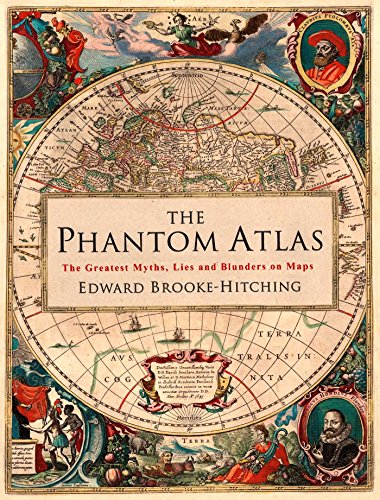
The Phantom Atlas is an atlas of the world not as it ever existed, but as it was thought to be. These marvellous and mysterious phantoms - non-existent islands, invented mountain ranges, mythical civilisations and other fictitious geography - were all at various times presented as facts on maps and atlases. This book is a collection of striking antique maps that display the most erroneous cartography, with each illustration accompanied by the story behind it.Exploration, map-making and mythology are all brought together to create a colourful tapestry of monsters, heroes and volcanoes; swindlers, mirages and murderers. Sometimes the stories are almost impossible to believe, and remarkably, some of the errors were still on display in maps published in the 21st century. Throughout much of the 19th century more than 40 different mapmakers included the Mountains of Kong, a huge range of peaks stretching across the entire continent of Africa, in their maps - but it was only in 1889 when Louis Gustave Binger revealed the whole thing to be a fake. For centuries, explorers who headed to Patagonia returned with tales of the giants they had met who lived there, some nine feet tall. Then there was Gregor MacGregor, a Scottish explorer who returned to London to sell shares in a land he had discovered in South America. He had been appointed the Cazique of Poyais, and bestowed with many honours by the local king of this unspoiled paradise. Now he was offering others the chance to join him and make their fortune there, too - once they had paid him a bargain fee for their passage...The Phantom Atlas is a beautifully produced volume, packed with stunning maps and drawings of places and people that never existed. The remarkable stories behind them all are brilliantly told by Edward Brooke-Hitching in a book that will appeal to cartophiles everywhere.

Record-setting Jeopardy! champion and New York Times bestselling author of Planet Funny Ken Jennings explores the world of maps and map obsessives, “a literary gem” (The Atlantic). Ken Jennings takes readers on a world tour of geogeeks from the London Map Fair to the bowels of the Library of Congress, from the prepubescent geniuses at the National Geographic Bee to the computer programmers at Google Earth. Each chapter delves into a different aspect of map culture: highpointing, geocaching, road atlas rallying, even the “unreal estate” charted on the maps of fiction and fantasy. Jennings also considers the ways in which cartography has shaped our history, suggesting that the impulse to make and read maps is as relevant today as it has ever been. From the “Here be dragons” parchment maps of the Age of Discovery to the spinning globes of grade school to the postmodern revolution of digital maps and GPS, Maphead is filled with intriguing details, engaging anecdotes, and enlightening analysis. If you’re an inveterate map lover yourself—or even if you’re among the cartographically clueless who can get lost in a supermarket—let Ken Jennings be your guide to the strange world of mapheads.

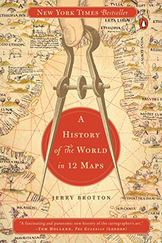
A New York Times Bestseller“Maps allow the armchair traveler to roam the world, the diplomat to argue his points, the ruler to administer his country, the warrior to plan his campaigns and the propagandist to boost his cause… rich and beautiful.” – Wall Street Journal Throughout history, maps have been fundamental in shaping our view of the world, and our place in it. But far from being purely scientific objects, maps of the world are unavoidably ideological and subjective, intimately bound up with the systems of power and authority of particular times and places. Mapmakers do not simply represent the world, they construct it out of the ideas of their age. In this scintillating book, Jerry Brotton examines the significance of 12 maps - from the almost mystical representations of ancient history to the satellite-derived imagery of today. He vividly recreates the environments and circumstances in which each of the maps was made, showing how each conveys a highly individual view of the world. Brotton shows how each of his maps both influenced and reflected contemporary events and how, by considering it in all its nuances and omissions, we can better understand the world that produced it. Although the way we map our surroundings is more precise than ever before, Brotton argues that maps today are no more definitive or objective than they have ever been. Readers of this beautifully illustrated and masterfully argued book will never look at a map in quite the same way again.“A fascinating and panoramic new history of the cartographer’s art.” – The Guardian “The intellectual background to these images is conveyed with beguiling erudition…. There is nothing more subversive than a map.” – The Spectator “A mesmerizing and beautifully illustrated book.” —The Telegraph

Travel the world without leaving your living room.This book of maps is a visual feast for readers of all ages, with lavishly drawn illustrations from the incomparable Mizielinskis. It features not only borders, cities, rivers, and peaks, but also places of historical and cultural interest, eminent personalities, iconic animals and plants, cultural events, and many more fascinating facts associated with every region of our planet.

Traditional world maps are drawn from the perspective of the first European explorers and cartographers - with the Northern Hemisphere at the top. We think it's time to break with tradition and show the world from the perspective of all those people living in the Southern Hemisphere. After all, there is no ancient geographical feature saying "This way up".

A refreshingly original history of the lost countries of the nineteenth and twentieth centuries, examined and illustrated with the countries’ postage stamps\nThese are the stories of fifty countries that once existed but have now have been erased from the map. Varying vastly in size and shape, location and longevity, they are united by one fact: all of them endured long enough to issue their own stamps.\nSome of their names, such as Biafra or New Brunswick, will be relatively familiar. Others, such as Labuan, Tannu Tuva, and Inini, are far less recognizable. But all of these lost nations have stories to tell, whether they were as short- lived as Eastern Karelia, which lasted only a few weeks during the Soviet– Finnish War of 1922, or as long- lasting as the Orange Free State, a Boer Republic that celebrated fifty years as an independent state in the late 1800s. Their broad spectrum reflects the entire history of the nineteenth and twentieth centuries, with its ideologies, imperialism, waves of immigration, and conflicts both major and minor.\nThe motifs and symbols chosen for stamps have always served as a form of national self- presentation, an expression of the aims and ambitions of the ruling authorities. Drawing on fiction and eye- witness accounts as well as historical sources, Bjorn Berge’s witty text casts an unconventional eye on these lesser- known nations. Nowherelands is a different kind of history book that will intrigue anyone keen to understand what makes a nation a nation. 100 illustrations

Nearly thirty years after the end of the Cold War, its legacy and the accompanying Russian-American tension continues to loom large. Russia’s access to detailed information on the United States and its allies may not seem so shocking in this day of data clouds and leaks, but long before we had satellite imagery of any neighborhood at a finger’s reach, the amount the Soviet government knew about your family’s city, street, and even your home would astonish you. Revealing how this was possible, The Red Atlas is the never-before-told story of the most comprehensive mapping endeavor in history and the surprising maps that resulted. From 1950 to 1990, the Soviet Army conducted a global topographic mapping program, creating large-scale maps for much of the world that included a diversity of detail that would have supported a full range of military planning. For big cities like New York, DC, and London to towns like Pontiac, MI and Galveston, TX, the Soviets gathered enough information to create street-level maps. What they chose to include on these maps can seem obvious like locations of factories and ports, or more surprising, such as building heights, road widths, and bridge capacities. Some of the detail suggests early satellite technology, while other specifics, like detailed depictions of depths and channels around rivers and harbors, could only have been gained by actual Soviet feet on the ground. The Red Atlas includes over 350 extracts from these incredible Cold War maps, exploring their provenance and cartographic techniques as well as what they can tell us about their makers and the Soviet initiatives that were going on all around us. A fantastic historical document of an era that sometimes seems less distant, The Red Atlas offers an uncanny view of the world through the eyes of Soviet strategists and spies.

Instructive, amusing, colorful—pictorial maps have been used and admired since the first medieval cartographer put pen to paper depicting mountains and trees across countries, people and objects around margins, and sea monsters in oceans. More recent generations of pictorial map artists have continued that traditional mixture of whimsy and fact, combining cartographic elements with text and images and featuring bold and arresting designs, bright and cheerful colors, and lively detail. In the United States, the art form flourished from the 1920s through the 1970s, when thousands of innovative maps were mass-produced for use as advertisements and decorative objects—the golden age of American pictorial maps.Picturing America is the first book to showcase this vivid and popular genre of maps. Geographer Stephen J. Hornsby gathers together 158 delightful pictorial jewels, most drawn from the extensive collections of the Library of Congress. In his informative introduction, Hornsby outlines the development of the cartographic form, identifies several representative artists, describes the process of creating a pictorial map, and considers the significance of the form in the history of Western cartography. Organized into six thematic sections, Picturing America covers a vast swath of the pictorial map tradition during its golden age, ranging from “Maps to Amuse” to “Maps for War.” Hornsby has unearthed the most fascinating and visually striking maps the United States has to offer: Disney cartoon maps, college campus maps, kooky state tourism ads, World War II promotional posters, and many more. This remarkable, charming volume’s glorious full-color pictorial maps will be irresistible to any map lover or armchair traveler.

Data Is Ubiquitous: It Shapes Our World In Intricate, Invisible Ways, And Influences The Way In Which We Live, Move And Connect. Drawing On Vast Datasets Gathered Through Mobile Phones, Satellites, Social Media, Archival Records And Scientific Research, The Award-winning Cartographers James Cheshire And Oliver Uberti Reveal These Hidden Patterns In Atlas Of The Invisible, Presenting An Unseen Story Of Humanity Through A Riveting Series Of Maps And Graphics. Certain To Change And Challenge The Way You See The World, Atlas Of The Invisible Invites Readers To Marvel At The Grandeur Of Data In All Its Promise And Peril, And To Revel In A New, Intimate Understanding Of People And Society Around The Globe Today.

Product Description \nAn unprecedented portrait of the hidden patterns in human society―visualized through the world of data.\nAward-winning geographer-designer team James Cheshire and Oliver Uberti transform enormous datasets into rich maps and cutting-edge visualizations. In this triumph of visual storytelling, they uncover truths about our past, reveal who we are today, and highlight what we face in the years ahead. With their joyfully inquisitive approach, Cheshire and Uberti explore happiness levels around the globe, trace the undersea cables and cell towers that connect us, examine hidden scars of geopolitics, and illustrate how a warming planet affects everything from hurricanes to the hajj. Years in the making, Atlas of the Invisible invites readers to marvel at the promise and peril of data, and to revel in the secrets and contours of a newly visible world.\nWinner of the 2021 British Cartographic Society Awards including the Stanfords Award for Printed Mapping and the John C. Bartholomew Award for Thematic Mapping.\n Review \n"An absolute visual delight."\n ―\nManuel Lima, author of The Book of Circles: Visualizing Spheres of Knowledge\\n"\nAtlas of the Invisible is full of mind-blowing maps that harness the power of data to tell us something about ourselves and our planet."\n ―\nHannah Fry, Professor in the Mathematics of Cities and author of The Complete Guide to Absolutely Everything\\n"Fantastic…a magical combo of art and graphic gut-punch."\n ―\nDave Eggers\\n"\nAtlas of the Invisible takes this literally, with design-heavy info-mapping of cellular connections in the Great Lakes, eviction rates, the ethnicity of immigrants living on South Halsted Street in 1895. A cartographer’s dream, and often revelatory."\n ―\nChristopher Borrelli, Chicago Tribune\\n"An eye-opening visual look at the assumptions and trends that lie beneath how the modern world ticks.…Demography and graphic design meet in an extraordinarily revealing book."\n ―\nKirkus Reviews (starred review)\\n"[T]his unique volume.…is designed to inspire readers to act."\n ―\nLibrary Journal\n From the Back Cover \nFrom the Preface:\n"For centuries, atlases depicted what people could see: roads, rivers, mountains. Today, we need graphics to reveal the invisible patterns that shape our lives. Atlas of the Invisible is an ode to the unseen, to a world of information that cannot be conveyed through text or numbers alone."\nPraise for Where the Animals Go:\n"A striking example of how innovative technology can be used to increase our understanding of the natural world."―Alan Smith, Financial Times\n"An enthralling volume, downright gorgeous in its illustrations and text."―Barbara J. King, NPR\n"Beautiful as well as inspiring."―Dr. Jane Goodall\n"A combination of the best in science and exposition, and a joy to study cover to cover."―E. O. Wilson\n About the Author \nJames Cheshire is professor of geographic information and cartography at University College London.\\nOliver Uberti is a Los Angeles–based designer and a former design editor for\nNational Geographic.